Hipperholme Lightcliffe Norwood Green


Hipperholme, Lightcliffe and Norwood Green.
Hipperholme,  Lightcliffe and Norwood Green although not really part of the Brighouse area but they tend to overlap and this group of villages are within the same ward that is included in the Calderdale Halifax ward, although some of the outer edges are tied in with some of the genuine villages of Brighouse, some may even have HX postcodes and the 01422 Halifax telephone dialling codes, with a few of these with the Brighouse codes or even a few with Bradford codes?.
Hipperholme according to some early records was the original wards which also included Brighouse along with Rastrick although many of these borders are still very vague and sketchy? Although the object of this website is not to give you a history lesson but to help improve the well been and prosperity of Brighouse and surround area along with the quality of life for the residents and improve the local business’s and town centre.
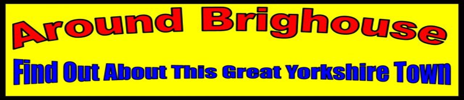
Hipperholme is built on the crossroads of the A58 (Leeds & Whitehall Road) Leeds to Halifax main road where it crosses with the A644 (Brighouse and Denholme Gate Road as the name implies its destination) Entering Hipperholme from the Stump Cross area and passing the Lee’s area before reaching the former site of the old Hipperholme Station site which closed in 1953, then you pass the sites of the old Tannery and the old Halifax Brewery (Ramsden’s?) which is new another house developments site, before approaching the Hipperholme crossroads with the Whitehall pub on the Leeds side of the traffic lights and the Hipperholme Wesleyan Methodist Chapel on the opposite side of the lights, turning right at the Hipperholme traffic lights and going down the Brighouse and Denhome Gate Road towards Hove Edge was the former Joseph Brooks Main Complex established in the mid eighteen hundreds for this massive Land Owners, Mineral and Stone Quarries along with a vast production of stone products including some of the first ever non-slip flags, they also made Chemicals including Bitumen Road Coating Products, following its closure in the late 60s early 70s most of the main site was taken over by Philips washing machine manufactures later to become Crosslee’s Tumble Dryer and electrical products.
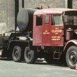
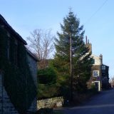
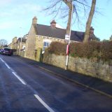
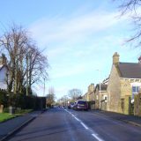
As Hove Edge boundary is approaching and is covered in a different section we will head back to the Hipperholme Traffic lights and crossing over the lights we go up the Brighouse and Denholme Gate Road before passing the Hipperholme Grammar School and then followed by Hipperholme’s own Ice Cream Maker next to the Hare and Hound Pub, further up the road becomes Shelf, Northowram and Coley so we will make our way back to the Hipperholme traffic lights this time turning left at the lights with its own busy parade of shops on the left, although if we take the side road off the A58 to the right down the Wakefield road and passing the Lightcliffe Stray on the left before reaching former site of the old Lightcliffe Station on the right that closed in the mid 60s with the Lightcliffe C of E Primary School on the left with the Old Coach Road opposite, followed by the remaining old Coach House Gate House on the right before approaching St Mathews Church, a bit further down on the left is the Lightcliffe Cricket Ground followed by the old graveyard with the remains of the old church tower dominating the centre of the grave yard.
On the opposite side of Wakefield Road is the Sun Inn as the boundaries become close to the village of Bailiff Bridge (which is covered in a different section) we will turn down the side of the Sun Inn (recently renamed as the Sun Country Inn) in to Stoney Lane which is part of the Stoney lane estate and down this Lane are two large schools the Cliffe Hill Community Primary School and Lightcliffe Academy, Further down the road is the Smith House and Whinney Hill estates and as beyond this area is covered in the Hove Edge section we head back to Wakefield Road and following our previous track turning left back up to the Lightcliffe C of E Primary School and turning right in front of this school along Knowle Top Road up to the A58 crossroads with the Lightcliffe Golf Club on the right at the junction and the Lightcliffe Christ Church just along the A58 to the left, although we are going straight across the crossroads down the side of the White Horse Inn in to Syke Lane which takes you in to the small quaint area of Priestley Green and then Norwood Green by taking the right at the ‘T’ junction in to Northedge Lane before turning right into Shutts Lane, going down this steep narrow lane you cannot help to notice some of these stunning property as you reach the dip in the road which is in fact a small bridge over a quaint little brook and beautiful Glade before climbing the steep little hill that brings you in to the delightful village of Norwood Green (reputed to hold the former name of Northwood Green) one of the most sought after places to live in the area.
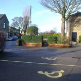
At the top of the hill it levels out in to Village Street on your right you are greeted by the stunning Jubilee Clock Tower or Ellis Clock Tower or even Ellis Memorial Clock Tower there seems quite a bit of confusion? Although they are all aiming at the same thing, it was built in 1897 as a memorial by Mrs Ellis and/or her daughters for her late husband/father Mr Ephraim Ellis of Low Moor or even to commemorate Queen Victoria’s Diamond Jubilee whatever the truth is you have to agree what a great clock tower.
Anyway moving on and beyond this tower in the village Green where you can absorb all the tranquillity of this beautiful village life, there is also the recently refurbished Village Hall run by volunteers, next to the now converted chapel is the Bus Turning Circle with a large roundabout of grass, further down on your left is ‘The Old White Beare Inn’ reputed to contain some timber in its original construction in 1646? (another bit of confusion, as on the pubs own website it states it was originally built in 1533 while the wood that is said to have been the source of the timber construction came from the British fighting ship which was still fighting the Spanish Armada in 1588? whatever it is still a great looking pub) from an British Ship that fought in the Spanish Armada in 1588? On your right as you make your way on Village Street is yet more grassed area again reputed to be where the Green came from in the name ‘Norwood Green’? one thing seems to stand out about this village is the upkeep of the property as there does not seem to be a blade of grass out of place, talking of grass for a small village there does still seems an abundance of well maintained grass which is a change to the normal building development that is currently taking over many villages?
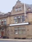
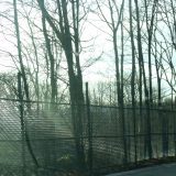
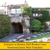
Moving through the village you come to a road on the right ‘Rookes Lane’ that joins up with the A58 Leeds and Whitehall Road, which passes the former dwelling for the Rookes family who was reputed land owners who added a high input not only to this village but surrounding areas, ignoring Rookes Lane the Village Street now becomes Station Road as it descends this beautiful village passing the Pear Tree Inn on the right before reaching the former ‘Norwood Green Railway Station’ before you reach the entrance to the stunning Judy Woods on the left that has to be one of the most beautiful and interesting country walks for miles around with a truly tremendous amount of beauty, wildlife, plants and views, this nature trail is very flexible and it can take you to Shelf or eventually Low Moor or just a woodland walk the choice is yours but please remember to take a supply of water as once to start on this trail you won’t want to turn back?
One strange thing for a village that has two pubs where are all the Take-Away’s and Shop’s? Maybe this is what makes this village so special.